|
IN BRIEF
|
Earth observation satellites play a crucial role in our understanding of our planet. With advanced technologies, these artificial devices move in orbit, allowing for precise and rapid remote sensing of large areas. They provide the ability to acquire detailed images of various regions in record time, which is vital for fields such as resource management, agriculture, the environment, and many more. Their applications are numerous and range from crop analysis to monitoring active volcanoes, making them indispensable tools for humanity.
Earth observation satellites play a fundamental role in our understanding of our planet. Thanks to their advanced technologies, they enable us to gather a multitude of data on geophysical and environmental phenomena. This article explores the different technologies used in this field, as well as the various applications of these satellites that impact our daily lives and contribute to the management of natural resources.
Technologies used by earth observation satellites
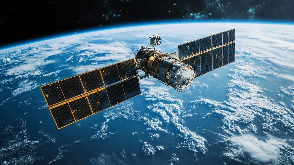
The technologies embedded in observation satellites are diverse and varied, tailored to the specific needs of each mission. One of the most innovative aspects is the use of laser communication, such as that of the TILBA® range, which allows for the transmission of Earth observation data at an extremely high speed and with unmatched reliability.
These satellites are equipped with sophisticated sensors capable of capturing images across different spectral bands. These sensors can monitor regions of several thousand square kilometers in a matter of seconds. Moreover, in a geostationary orbit at 36,000 km above the Earth’s surface, they can continuously scan the same part of the planet.
Applications of earth observation satellites
The applications of earth observation satellites continue to explode, covering a vast array of fields. Thanks to remote sensing, these satellites offer essential tools for environmental monitoring, conducting crop inventories, analyzing risk zones, and much more. For example, the study of active volcanoes and the analysis of risk areas help protect populations through better anticipation of natural events.
The data collected by satellites also allow for precise analyses of land use, climate change, and water resource management. With near-instantaneous communication, these technologies facilitate decision-making by providing crucial information to government actors and research organizations.
Impact of satellites on our daily lives
Earth observation satellites enhance our daily lives in sometimes unexpected ways. Whether for weather services, navigation, or disaster management, these tools have become indispensable. Furthermore, they also contribute to the monitoring of natural resources, which is crucial for the sustainability of our planet.
In summary, observation satellites are valuable devices that not only provide essential data for scientific research but also produce varied applications that serve humanity. They help us better understand terrestrial dynamics and anticipate current and future environmental challenges, thereby enabling more informed management of natural resources.
Conclusion on earth observation technologies
Satellites, as advanced observation tools, continue to evolve and transform our way of perceiving and managing the Earth. Their innovative technology and the multiple applications they offer demonstrate the increasing importance of these devices in a constantly changing world. Every day, thanks to these technologies, we take another step towards a better understanding of our planet and its challenges.
Technologies and Applications of Earth Observation Satellites
| Technologies | Applications |
| Multispectral sensors | Monitoring crops and agricultural inventories |
| Laser communication | Transmission of data at very high speed |
| Geostationary satellites | Continuous observation of a specific region |
| Remote sensing | Study of climate change and natural disasters |
| Radar imaging | Mapping flooded areas and terrain |
| Hyperspectral analysis | Detection of pollutants and assessment of air quality |
| LiDAR technology | Modeling of land surfaces and vegetation |
Earth observation satellites represent a major technological advancement that has transformed our understanding of our planet. With remote sensing systems, these satellites allow us to monitor environmental changes, analyze geophysical data, and support various practical applications, particularly in agriculture, resource management, and disaster response. This article explores the technologies behind these satellites and their many uses.
Technologies of earth observation satellites
Earth observation satellites use sophisticated sensors to collect precise data on the Earth’s surface. In orbit at altitudes ranging from a few hundred to several thousand kilometers, these devices can acquire high-resolution images of vast areas in seconds. The range of available technologies includes not only optical cameras but also radar instruments and infrared sensors, allowing for detailed observation regardless of the weather.
A notable example of recent technology is the TILBA® range, which ensures reliable laser communication for transferring data at very high speeds. This allows for near-instantaneous reception of earth observation data, making analyses and improvements even faster and more efficient. These satellites continue to evolve, paving the way for new observation capabilities.
Applications of earth observation satellites
The applications of earth observation satellites are vast and varied, covering many essential fields. In the agricultural sector, these satellites enable the conducting of crop inventories by providing synoptic views of the fields, thus helping farmers optimize their yields. In the environmental sector, they are crucial for tracking climate change, deforestation, and water management.
In terms of risk management, these satellites play a key role in monitoring risk zones such as active volcanoes. For example, the project on active volcanoes uses satellite data to identify threatened areas and improve safety protocols.
Furthermore, they contribute to applications in communications and navigation, offering global coverage and access to real-time data. These interconnected systems reveal the power of modern satellites capable of serving humanity in multiple aspects of daily life.
- Communication Technologies: High-speed laser communication.
- Spatial Coverage: Rapid observation of large surfaces.
- Remote Sensing: Acquisition of multiple images of the same region.
- Durability: Increased longevity of satellites in orbit.
- Agricultural Applications: Crop inventories and monitoring of crops.
- Environmental Monitoring: Geophysical and geographical observations.
- Risk Prevention: Studies of risk areas such as active volcanoes.
- Navigation: Improvement of positioning systems.
- Mapping: Updating accurate geographical data.
- Climate Change: Monitoring climate variations.
Introduction to earth observation satellites
Earth observation satellites play an essential role in our understanding of our planet. With advanced technologies, these devices orbit the Earth and allow for geophysical and geographical observations. They provide valuable data for various applications, ranging from environmental monitoring to the management of natural resources. This article explores the main technologies used by these satellites as well as their multiple applications.
Technologies of observation satellites
Remote sensing systems
Earth observation satellites are equipped with remote sensing systems that allow them to collect information about the Earth’s surface using sensors. These sensors can measure different wavelengths, capturing visual, infrared, and other types of data. Satellites, equipped with high-resolution cameras, take thousands of images of the same area in record time, making it possible to observe large surfaces in just a few seconds.
Laser communication
The laser communication technology proves extremely useful for data transfer. The TILBA® range is a pertinent example, allowing for earth observation data to be received at very high speeds. With this method, information can be transmitted in a highly reliable manner, thus ensuring immediate access to precise and up-to-date data.
Applications of observation satellites
Environmental monitoring
Earth observation satellites are essential for environmental monitoring. They track climate changes, detect natural disasters, and monitor ecosystem health. Through their data, it is possible to analyze the impact of human activities on the environment and to plan protection strategies.
Natural resource management
These satellites also play a crucial role in natural resource management. They facilitate agricultural inventories by monitoring crop conditions and predicting yields. Additionally, they are used to monitor water stocks, track deforestation, and aid in sustainable management of forests and coastal areas.
Navigation and transport
Satellites significantly contribute to navigation and transport. By providing positioning services, they enable more efficient management of maritime and air routes. Satellite data is essential for optimizing delivery routes, reducing transport times, and minimizing associated carbon emissions.
Scientific applications and research
Finally, earth observation satellites are a valuable resource for scientific research. They allow scientists to study phenomena such as active volcanoes by monitoring risk areas or providing data on coastal erosion. By supporting this research, satellites help formulate strategies to mitigate associated risks.